Strada Alta
Hike through villages whose names sound like music
Up to the south
Once you have left the Gotthard behind you, “geographically it goes downhill and inwardly uphill”, is how the Allgäu writer Gerhard Köpf summed up the longing for the south.
That was in the 1980s, when the opening of the highway reduced travel times. The Leventina finally became a transit corridor, where you might stop to fill up your gas tank on the way to Lake Maggiore or the Mediterranean shores. Paradoxically, it was precisely in those years that the philosophy of deceleration gained momentum. The high-altitude hike on the Strada Alta became the Swiss hiking classic par excellence, sung about by the Ticino entertainer Nella Martinetti: “With you, Strada Alta, you breathe the joy of life.”
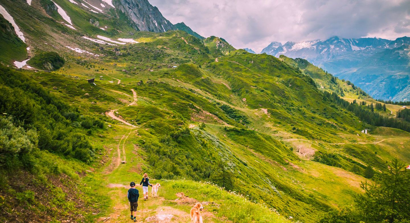
Madrano, Brugnasco, Altanca, Ronco, Deggio, Lurengo, Freggio, Osco, Mairengo, Anzonico, Calpiogna, Sobrio ... The names of the villages along the Strada Alta have a cheerful, cheerful sound; you can literally feel when you pronounce them that they all lie on the eastern, sunny side of the Leventina, high above the busy valley floor with its railroads and roads. The motto up here is: slow down. The 45 kilometers between Airolo and Biasca can be divided into three easy one-day routes. “Some sections are on hard surfaces, others seem wild and breathtaking,” writes hiking blogger Thomas Widmer, who concludes: ”Overall, the dramaturgy is just right.”
Three stages
Stage 1: Airolo – Osco
The first act begins in Airolo, 1,140 meters above sea level. The start includes a refreshing coffee and brioche. The Piazzetta bar at the Hotel Motta is the perfect place for this - after all, Giuseppe Motta, a member of the Federal Council, is a descendant of the family. After this refreshment, we head towards Valle. You cross the Val Canaria ravine on the old mule track. You soon reach Madrano. At Brugnasco you have already gained some altitude. The path leads under the tracks of the Ritom railroad to Altanca. If you look down from this hamlet with its sunburnt wooden houses to the highway in the valley, you can't help but notice: poor motorists, you're missing out on the essentials.
While the A2 winds its way southwards on the plain of Quinto, the Strada Alta climbs gently. At the hamlet of Cresta, you reach the highest point of the hike at 1,419 meters above sea level. The route continues via Ronco and the village of Deggio to the eleventh-century chapel of San Martino. Here the route leaves the road and leads across hay meadows to Lurengo and then through the Bosco d'Öss, an idyllic forest above the Piottino gorge. The route descends the steep slope on stone slabs, past gruesome vertical slopes to Osco, a village where the mule track rights were recorded as early as 1237. In addition to the Gotthard traffic, agriculture provided the population with a livelihood - at least until the 19th century. After that, an unprecedented exodus set in. Between 1850 and 1950, the population of Osco fell from 452 to 188 people. Many sought their fortune as cooks, waiters, innkeepers and hoteliers in the New World. Like Alessandro Pedrini, one of four people from Ticino who died when the Titanic sank.
Depending on your walking pace, you will have around five hours under your belt when you arrive in Osco, the destination of the first stage. If you can't find accommodation locally (there are only a limited number of beds available at the Ristorante Marti and the Osteria Salzi), take the Postbus down to Faido, where there is usually a good chance of finding a free room. With the first morning post, you can then resume the hike you interrupted the day before. For cheerful Nella Martinetti, the return to the high plateau was always associated with many emotions: “Every time I come back up, I fall in love with you, Strada Alta.”
Stage 2: Osco – Anzonico
The rest of the route offers “a carousel of a thousand colors”, to quote Martinetti's song lyrics, “meadows, mountain streams, flowers, waterfalls and old churches” line the edge of the path. The Campanili do indeed point the way to Rome like lighthouses. The whitewashed church of San Martino outside Calonico, for example, is visible from afar, perched high on a striking rocky promontory above the precipice and first mentioned in 1200.
Stage 3: Anzonico – Pollegio/Biasca
You realize just how high you are above the valley floor on the last section of the route, which leads from the village of Anzonico, population 100, to Biasca. It is the most romantic but steepest section of the Strada Alta. The old mule track leads over huge rocky pulpits and through secluded chestnut forests to the unique open-air staircase above Pollegio. The descent covers 1150 meters before you tackle the last few meters to Biasca, singing Nella Martinetti's refrain: “Strada alta, tutta mia!”
Experience
The Strada Alta panoramic trail measures 45 kilometers. The detailed route is available at www.stradaalta.ch. As there are fewer and fewer places to stay along the route, it is advisable to plan well and make reservations.
An overview of the inns and B&Bs in the Leventina can be found on the Bellinzona Turismo website: www.bellinzonese-altoticino.ch.
Arrival: with the Treno Gottardo to Airolo